Category Archives: Fishing Spots

Burrum River, Queensland

Burrum River sanctuaries ... there are boat ramps at Burrum Heads, Buxton, Walkers Point and Pacific Haven
Burrum River sanctuaries … there are boat ramps at Burrum Heads, Buxton, Walkers Point and Pacific Haven

The Burrum River flows to sea into Hervey Bay at the town of Burrum Heads.

Most fishing in the river is done around Burrum Heads, an area of shallow channels and drying sandbars.

Whiting and flathead are the main catch, along with mangrove jacks, grunter, queenfish, salmon, cod, trevally, dart, gar, tailor, jewfish and pike.

For those who specialise, barramundi can be found in small numbers.

The upper river is impounded by Lenthalls Dam at the joining of watercourses Harwood Creek, Woolmer Creek and Duckinwilla Creek, near Burrum.

Below Lenthalls Dam the river is impounded by Burrum River Weir No.2, built in 1951, and Burrum River Weir No.1, built in 1900.

The river flows under the Bruce Highway near Howard and past Pacific Haven.

The Isis River joins the Burrum River at the Burrum Coast National Park.

Together, these rivers eventually join with the Gregory River before discharging into the sea.

The river descends 27m over its 31km course. The estuary is 12km long and up to 2km wide.

The catchment area is low and flat and is located between the Burnett and Mary River catchments.

To visit Burrum Heads, from the Bruce Highway take the Torbanlea exit, turn left onto Burgowan Road, and then turn onto Burrum Heads Road.

There are two boat ramps at Burrum Heads, with the larger one having multiple lanes and a pontoon and much more parking than the smaller ramp on nearby Ross St.

There are other boat ramps at Buxton, Walkers Point and Pacific Haven.

The lower river is broad but shallow, forming drying flats, channels and gutters as the tide falls.

Flathead, bream and whiting are king here.

Marine fish and mud crabs move far upstream during dry periods, and heavy rain pushes them back down.

The river has a good run of prawns at times, with numbers varying each year.

Fishing flats edges produces flathead and whiting.

Any rock patch might have mangrove jacks, cod and bream.

Nippers are available on the flats and these are the best bait for big whiting.

Livebaiting upstream holes is a great way to find cod, barramundi, flathead and mangrove jacks.

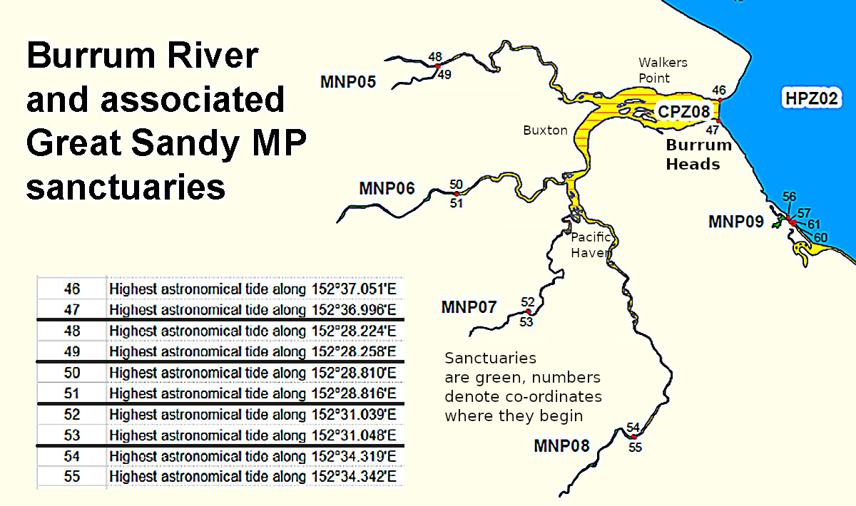
Note that the upper river and its tributaries are sanctuaries, part of the Great Sandy Marine Park.

The river is known for its tidal current so be sure to anchor crab pots well or put them in eddies or otherwise out of the current.

Expect chop to appear quickly on the biggest tides.

The Black Bank north of Burrum Heads itself has grunter.

Outside the river mouth, Hervey Bay produces a mix of temperate and sub-tropical species, with seasonal pelagics such as tuna and mackerel.

The best time to fish is before holiday periods, as Burrum Heads becomes busy during these times and many visitors are fishing.

If planning to fish during a holiday period, be sure to book holiday accommodation early.

Burrum Heads tides
Burrum Heads coastline at Beachsafe
Great Sandy Marine Park Zoning Map
Qld dam water levels
Qld stocked dam permits
Queensland fishing regulations

Email corrections, additions, pictures or video here.

Hinchinbrook, Queensland

The Hinchinbrook region’s fishing appeal lies mainly in the 45km channel that runs between Hinchinbrook Island and the mainland.

This vast, relatively sheltered area has hundreds of kilometres of mangrove-lined creeks and flats, located away from major population centres.

While the channel is the main attraction, visiting fishos can also enjoy beach fishing, wharf fishing at Lucinda and Dungeness, freshwater fishing in the Herbert River, and offshore fishing out to the Great Barrier Reef for the full gamut of tropical species.

As well as great fishing, this area has great scenery, with a backdrop of rainforest-covered mountains.

Hinchinbrook is 200km south of Cairns, about half way between Cairns and Townsville.

The northern end of the channel has the tiny township of Cardwell on the highway, with the smaller Lucinda settlement at the southern end.

This is a true tropical location, with heavy rainfall and high humidity in summer, and cooler dry weather in winter.

The area is sometimes hit by summer cyclones, which bring prolonged heavy rain that is good for fishing on the long term.

The larger cyclones also bring destruction, including extensive damage to the mangrove forests.

Species caught in the channel and island creeks include barramundi, queenfish, salmon, mangrove jacks, trevally, permit, fingermark, grunter and cod.

Mud crabs and prawns are usually abundant, with seasonal variations.

The channel is a huge area, about 6km across at its widest point, so there are usually places to fish away from other boats.

Prevailing winds at the time may help choose your location.

Casting baits or lures to the mouths of mud drains as the tide flows out is an effective method for catching barramundi during bigger tides.

Trolling quietly up creeks also works well on smaller tides when the water is clear. An electric motor is useful for this.

On a large incoming tide look for baitfish or predator activity along flats edges.

Drifting along creeks with the current and casting lures to snags is a very popular fishing method for catching barramundi, mangrove jacks and cod.

Rocky foreshores and rock walls are always worth fishing.

The water in the channel, depending on prevailing winds, can be quite clear on the flats, allowing for good sight fishing.

Local sardines, herring and small mullet are the ideal livebaits and will almost always produce fish if dropped at a creek mouth or near a decent snag.

Deep grounds yield fingermark and jewfish.

Though Hinchinbrook tides are not huge, with 3m of movement being a big tide within the channel, strong currents flow, so fish deeper areas at the turn of the tide.

Use a sounder to locate bottom fish.

The channel really fires after big wet seasons, when the freshwater has subsided.

Dry years bring slower fishing as the bait cycle winds down.

Cyclones produce fallen mangrove timber, and the submerged horizontal logs often hold a barramundi or two, or mangrove jacks.

Missionary Bay on the north-west end of the island is a series of creeks and flats that produces good fish, but should only be visited in calm weather.

The southern coast inside the island has the Herbert and Seymour River mouths, with mangrove islands and channels. The upstream freshwater sections have sooty grunter and jungle perch.

From Lucinda it is a 38km run out to the first Great Barrier Reef, which is Bramble Reef

Most local fishos head the extra few kilometres to the larger and more complex Britomart Reef.

Britomart has an extensive plateau and reasonable shelter for anchoring.

The bommies have trout and tropical lobsters (crays), and deep water around the edges holds red emperor, trout, nannygai, sweetlip and more.

Britomart fishes best on big tides, although some fishermen prefer fishing the deep water between the reefs on small tides where hard bottom can produce fish such as nannygai and red emperor.

Expect mackerel and trevally around the reef edges.

Closer to Dungeness, the Sea Hound trawler wreck is a popular spot, but it can be busy on weekends.

The Sea Hound is about 17km north-east of Lucinda, at approx 18 24.433S 146 25.742E.

This area has large crocodiles, so take care when fishing. Crocs can show up on seaward beaches too.

While Hinchinbrook is located far from major cities, expect local van parks to be overflowing during holiday periods.

There is no nearby stocked dam in this area, the nearest is Koombooloomba located further north towards Cairns.

Get the best Hinchinbrook fishing spots in the North Australian FISH FINDER book of fishing maps.

Hinchinbrook boat ramps

Dungeness, Lucinda – four- lane concrete ramp, pontoon, wash-down area, trailer parking, security lighting, toilets. Gateway to Great Barrier Reef and Hinchinbrook Channel.

Mona Landing, Halifax, on the Herbert River – single-lane gravel ramp and small gravel car park. Access to the Herbert River and 15-minute run to Hinchinbrook Channel.

Taylors Beach – Double-lane concrete ramp, wash-down, security lighting, toilets.

Forrest Beach – Single-lane concrete ramp, large bitumen carpark, toilets, washdown, exposed to wind and waves.

Cassady Beach – Single-lane concrete ramp, small car park, washdown, no good at low tide.

Hinchinbrook coastguard

Ingham Volunteer Coast Guard – VHF Channel 16 or VHF Channel 81

Lucinda tides
Cardwell tides
Hinchinbrook Island National Park
Great Barrier Reef zone map
Qld dam water levels
Qld stocked dam permits
Qld fishing regulations

Email corrections, additions, pictures or video here.

Moreton Bay Artificial Reefs – Curtin Artificial Reef

Curtin Artificial Reef is Moreton Bay’s biggest artificial reef in terms of the sheer number and size of components.

The reef is north of Cowan Cowan on the west side of Moreton Island in depths ranging from 16m to 27m.

The site was created in 1968 by the Underwater Research Group of Queensland, whose members have sunk vessels, cars, tires and pontoons over several decades.

The reef is a “junk reef”, meaning it is not made from purpose-built components.

The first wreck sunk was the Amsterdam barge in 1968, and the last installed was the Hustler in 1998.

The largest wreck is the 50m coal barge Bremer.

The smallest wreck is the concrete 10m yacht Solace.

Other wrecks include two whale chasers from the former Tangalooma whaling station on Moreton Island.

A total of 32 ships, car bodies, buoys, concrete pipes and tyres were installed.

While there are many structures to fish, this site gets very busy on weekends.

Strong currents flow through this area and heavy sinkers are required.

Anchoring off the wrecks on sand and dropping baits back can work well the tide is flowing.

The turn of the tide and night are the best times to fish.

Curtin Artificial Reef Fish Species

This site attracts a huge range of fish, including large rays, sharks and groper.

Boaters can expect kingfish, cobia, trevally, pink snapper, tricky snapper (“grassies”), bream, flathead and spotted, school and spanish mackerel.

Barracuda school on the wreck, and wobbegong and leopard sharks are often present, as well as passing whaler, hammerhead, bull and tiger sharks.

Curtin Artificial Reef Fish Species GPS Marks

The reef is marked with buoys and the components are spread in a rough north-south direction.

The site is at WGS84 mark approximately 27 06.700S 153 21.780E.

Sound around and mark the various lumps before picking a spot to fish.

This reef was created by divers and is still popular with divers, so take care when dive boats are using the site.

Back to the NSW/ACT Fishing Map
Back to the NT Fishing Map
Back to the Queensland Fishing Map
Back to the SA Fishing Map
Back to the Tasmanian Fishing Map
Back to the Victorian Fishing Map
Back to the WA Fishing Map

Email corrections, additions, pictures or video here.