York Peninsula Part One, South Australia

Yorke Peninsula, South Australia
Yorke Peninsula council-run camp sites
Yorke Peninsula marine reserves

See Part Two of this article here.

Some great fishing can be had in the upper Gulf of St Vincent from Port Wakefield and south down the York Peninsula coast.

The mostly sandy shallows in the upper gulf have prolific seagrass meadows that are home to plenty of whiting, squid, flathead, gar and flounder, along with runs of blue crabs.

At the foot of the peninsula, places like Marion Bay have superb offshore fishing for samsonfish, kingfish, tuna and more.

Price

This community on the upper western Gulf of St Vincent has two creeks with mostly juvenile fish.

Launching by 2WD into Wills Creek is at high tide only if you don’t have 4WD.

Private (illegal) artificial reefs have been sunk in the upper gulf and these hold pink snapper in summer.
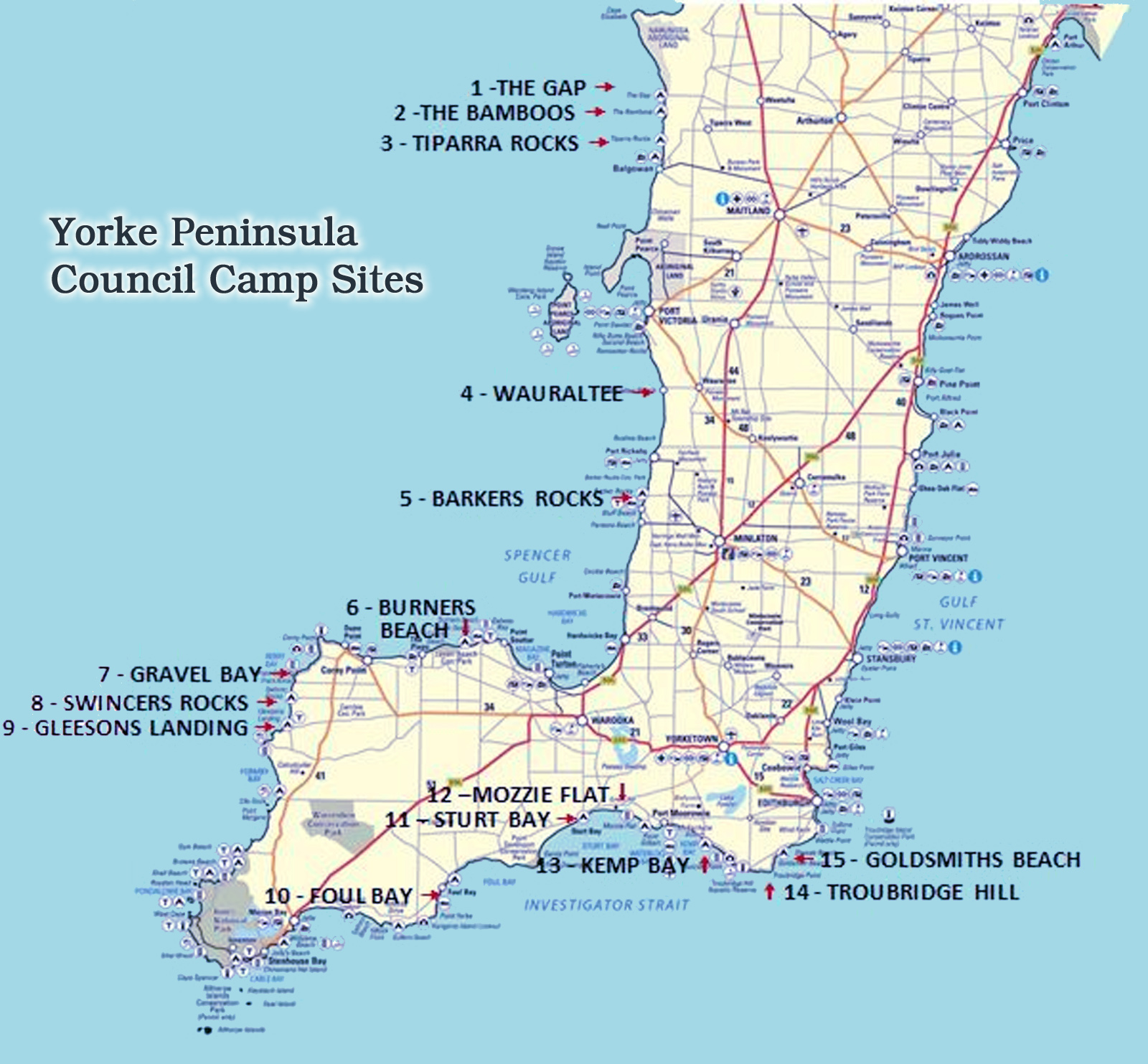
Ardrossan

This town is somewhat famous among fishos for its great fishing jetty, but it now also has a purpose-built “natural” artificial reef.

The 4ha reef is made of concrete reef balls, limestone, oyster shells and live native oysters.

Ardrossan has outstanding crabbing, along with squid, tommy ruff, gar and yellowfin whiting.

There are good all-tide boat launching facilities, and a hopper barge artificial reef 15km offshore holds snapper in summer.

Black Point

This holiday community is on a wide shallow bay, and being on the west side of the gulf the winds are offshore in summer.

The main catch in the shallow bay are yellowfin whiting, flathead, flounder, yellow-eye mullet, gar, squid and blue crabs.

There are snapper offshore, but finding ground, or someone’s private artificial reef, can be difficult.

Black Point launch site is exposed, and dries as the tide falls.

Nearby Port Julia has a small jetty that dries at low tide, and a basic launch site.

Squid are caught off the point at high tide, best in early mornings and late afternoons when the water is calm and clear.

Port Vincent

This small town has a marina that provides sheltered all-tide boat launching.

Unlike many gulf towns, there is no fishing jetty.

The attraction for boaters is Orontes Bank about 15km offshore, which produces king george whiting, gar, snapper and squid.

The whiting here are generally bigger than those in the far upper gulf.

There is a blue crab run in summer.

North Spit north of Port Vincent is a great low-tide location for blue crabs.

Garfish dabbing is best on a dark night (no moon).

Stansbury

The jetty produces king george whiting at the far end, and garfish, yellowfin whiting, tommy ruff, snook and squid.

There is a good summer run of blue crabs, usually raked around South Spit.

The boat ramp is excellent.

Along the coast north of Stansbury are excellent squidding grounds.

Wool Bay

There is a short jetty which produces mostly squid, gar and tommy ruff.

The launch site is poor and requires 4WD.

Port Giles

The long loading jetty here produced big snapper in years past.

Otherwise, tommy ruff, slimy mackerel, chow, trevally, squid and gar are the main catch.

The jetty is closed when grain is being loaded.

The rocks to the north are known to produce snapper, usually after a storm.

South of Port Giles, Salt Creek Bay at Coobowie has yellowfin whiting, mullet and flounder.

There is a tyre reef 3km off Giles Point.

Giles Tyre Reef approx 35 02.715S 137 47.483E

Edithburgh

The small jetty here punches above its weight, with tommy ruff, garfish, snook and squid. Night is best.

The boat ramp is adequate and king george whiting caught on nearby grounds are usually of a good size.

There is snapper and more at Troubridge Shoals, Tapley Shoal and Marion Reef for those with suitable boats.

Currents can be strong and fishing is best done at the turn of the tide.

Marion Bay

This large bay is under the “foot” of Yorke Peninsula near the entrance to Dhilba Guuranda-Innes National Park.

It is one of two places where boats can be launched along the bottom end of the peninsula, the other being Pondalowie Bay.

Marion Bay is not an ideal launch site however, being exposed, a single lane, poor at low tide and sometimes affected by weed.

A 4WD is needed to launch and retrieve.

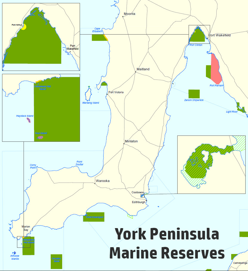
There is a large marine sanctuary zone in this area but it includes a shore-based exclusion zone where fishing is permitted.

The long jetty fishes well for squid, gar, tommy ruff and mullet.

The beach within the bay is renowned for its autumn mullet run.

The worms found in the beached seaweed mounds are great bait for the mullet, but mince and cockle also works well.

Boaters who want to catch large king george whiting should launch here and go 25km east to Foul Bay.

Offshore grounds in this region produce huge whiting, samson, blue morwong, harlequin fish, yellowtail kingfish, trevally, snapper, nannygai, sharks and more.

Here is the SA seasonal fishing calendar for various fish species.

Book your fishing stay early at Booking.com

Price tides
Ardrossan tides
Black Point tides
Port Vincent tides
Stansbury tides
Wool Bay tides
Port Giles tides
Edithburgh tides
Marion Bay tides
SA fishing regulations
SA marine parks

See Part Two of this article here.

Email corrections, additions, pictures or video here.

Deep Creek National Park, South Australia

Blowhole Creek beach is at the western boundary of Deep Creek Conservation Park.

This is one of seven small beaches along a steep and mostly inaccessible section of coast on the south side of Fleurieu Peninsula.

Two of these beaches in the Deep Creek Conservation Park are accessible to the public by 4WD, with the remainder backed by farmland.

The park is 100km from Adelaide.

It has five campgrounds, four of them accessible by 2WD vehicles.

The other campground is walk-in only on the Heysen Trail, which gives walking access to coastal areas.

There are 15 walking trails in the national park, with spectacular views of Backstairs Passage, Kangaroo Island and Deep Creek Valley.

Access to Blowhole Creek beach is via a steep 4WD track, but 2WD visitors can park at Cobblers Hill and walk a steep 2km to the beach and rocks.

A small creek runs across the beach, with fishable rocks extending seaward in each side.

The western side of the beach has a good platform.

The beach itself is small, being only 120m or so wide.

From the rocks anything might be caught, although the usual catch is tommy ruffs, salmon trout, silver and spotted whiting, red mullet, flathead and squid.

Those who take time to access the more remote rocks will find big leatherjackets, sweep and more.

Kingfish and silver trevally might show up on a good day.

Boat Harbour Beach

This is a straight 100m-wide steep cobblestone beach, with a low-tide sandbar.

It is at the end of a deep valley, with a 4WD access track zigzagging down the western spur.

Fishermen find this interesting spot to be hot or cold.

Salmon trout are the most likely catch.

Tunkalilla Beach

To the east of Deep Creek National Park is Tunkalilla Beach.

This 5km beach is accessible from a carpark on a bluff above the western end of the beach.

It is a long walk, especially on the way back.

It should be fished in light weather, preferably a northerly.

It has good salmon fishing at times, with mulloway or snapper a chance at night in spring and summer.

It is renowned for sharks in summer.

Beaches further east include Callawonga Beach, Ballapanudda Beach and Coolawanga Beach.

These may be accessible off the Heysen Trail, but check with trail organisers first.

Interestingly, Callawonga Creek was shown to hold trout in a 2013 government survey.

Further to the east are Parsons and Waitpinga Beaches, which are long, high-energy surf beaches that are publicly accessible and well-proven salmon fisheries, with a chance of tailor, mulloway and sharks.

Here is the SA seasonal fishing calendar for various fish species.

Book your fishing stay early at Booking.com

Deep Creek tides
Deep Creek Conservation Park
Blowhole Beach at Beachsafe
Boat Harbour Beach at Beachsafe
Tunkalilla Beach at Beachsafe
SA fishing regulations
SA marine parks

NOTE: Special snapper rules apply in South Australia – more info here.

Email corrections, additions, pictures or video here.

Lake Macquarie, New South Wales

Lake Macquarie is a superb fishing estuary with 170km of shoreline, much of which landbased fishos can access.

Boaters have 11,000ha of water to explore, with the lake averaging 9.7m deep.

The lake itself has an artificial reef system, and an offshore artificial reef lies 3.5km north-east of the Swansea bar.

The main species caught are yellowfin bream, dusky flathead and sand whiting.

Luderick, snapper, chopper tailor, tarwhine and prawns are also abundant at times, as are flounder and squid.

Larger fish such as mulloway, kingfish, big tailor and trophy flathead are targeted by some, usually in or near the entrance channel.

Snapper and mulloway inhabit deeper areas, mostly biting at night.

Dolphin fish (dorado) have been caught in the lake, although this is unusual.

Fishing has improved markedly since commercial netting was stopped in 2002.

There is usually somewhere sheltered to fish in almost any wind, but the lake is shallow and can become rough, especially in a southerly.

Skippers should watch for flats that trap boats on a falling tide.

Swansea Channel is the pick of the spots and has an easily accessible wall along the entrance’s north shore, but fishing is problematic because strong currents flow despite the relatively small local tides.

The turn of the tide is the best time to fish.

Being shallow and clear, the lake should be fished with light tackle and fresh bait.

Week days may fish best when there is less boat traffic.

Summer prawns are taken at night on the run-out tide and dark moon.

Squid are best at the channel entrance and near the bridge.

Hire boats and canoes are available.

EPA warning: Mud crabs and blue swimmer crabs are in the lake, but it may not be safe to eat them because of heavy metal contamination from nearby coal plants, read more about it here.

Lake Macquarie fishing spots

Shingle Splitters Point – great landbased fishing for flathead, whiting and bream. Located in Shingle Splitters Point Park, Queen Street, Balcolyn.

Belmont Bay – great landbased fishing for bream, flathead, tailor, snapper. There is a pier and boardwalk. Belmont Bay north to Speers Point has deep water, and there is a rocky shore between Green Point and Valentine. Expect bream, tailor, whiting, flathead, occasional school mulloway and snapper.

Speers Point jetty – tailor, bream, whiting, squid.

Valentine boat ramp area – another good family fishing spot with playground and picnic area.

Murrays Beach foreshore – large area of fishable foreshore with a jetty.

Croudace Bay – boat fishing for most species.

Swansea Channel – one of the best spots, best fished by boat on the turn of the tide. Expect most species, with shoals of Australian salmon making for some hectic fishing.

The Drop Over – fish the relatively sheltered waters near Marks Point for flathead, bream, whiting, kingish, squid and prawns.

Suburban Pelican foreshore – good area for some comfortable family fishing.

Pulbah Island – this is the biggest island in the lake. Boat fishing for most species, especially bream and tailor, with chance of mulloway in the deep areas.

Salts Bay – this is just outside the entrance, often home to salmon schools, with mulloway and pink snapper are also caught there.

Lake Macquarie Artificial Reef

The reef system is off Galgabba Point in 6m of water.

There are six sites, comprising 600 hollow concrete reef balls, each 1m square, within a 3sqkm area.

About 42 species are known to live on the reefs.

The reef is usually most productive for flathead, bream, tailor and leatherjackets.

The GPS supplied here is the central mark followed by four corner marks for each site.

Site 1.
33 05.604S 151 36.612E
33 05.614S 151 36.616E
33 05.605S 151 36.602E
33 05.597S 151 36.607E
33 05.606S 151 36.624E
Site 2.
33 05.680S 151 36.738E
33 05.697S 151 36.738E
33 05.670S 151 36.748E
33 05.666S 151 36.739E
33 05.692S 151 36.728E
Site 3.
33 05.764S 151 36.790E
33 05.755S 151 36.787E
33 05.759S 151 36.782E
33 05.773S 151 36.791E
33 05.770S 151 36.799E
Site 4.
33 05.814S 151 36.891E
33 05.807S 151 36.885E
33 05.813S 151 36.877E
33 05.822S 151 36.899E
33 05.817S 151 36.905E
Site 5.
33 05.880S 151 36.879E
33 05.879S 151 36.870E
33 05.885S 151 36.874E
33 05.884S 151 36.888E
33 05.875S 151 36.881E
Site 6.
33 05.985S 151 36.942E
33 05.978S 151 36.949E
33 05.976S 151 36.942E
33 05.990S 151 36.933E
33 05.997S 151 36.942E

There are also some ‘private’ (illegal) artificial reefs in the lake.

Lake Macquarie (Newcastle) Offshore Artificial Reef

This reef is 3.5km north-east of the Swansea bar, offshore from Blacksmiths Beach, at a depth of 28.5m. It was deployed in August 2019.

The reef is two single steel pinnacle towers of 7.8m wide by 10.9m deep and 6.4m high, each having a central vertical tower of 12m.

Yellowtail kingfish, snapper, silver trevally, mulloway, yellowtail and slimy mackerel exist around the reef.

Site 1. 33 04.300S 151 42.018E
Site 2. 33 04.380S 151 41.891E

Book your fishing stay early at Booking.com


fish finder book

Lake Macquarie tides
Lake Macquarie coastline
NSW fishing regulations
NSW marine parks

Email corrections, additions, pictures or video here.

Book your fishing B&B early at Booking.com


Buy Redback on eBay